Fishing, Mining, And Warfare - The Surprising Reason China Is Mapping The World's Oceans
In what some experts are deeming a geopolitical powerplay, China has dramatically scaled its deep-sea exploration program, targeting strategic waterways with major security, economic, and climate implications. The effort, which harkens back to at least 2020, has seen Chinese research organizations associated with the People's Liberation Army (PLA) mapping the seafloors of the Pacific, Indian, and Arctic oceans. Experts warn that this research could lay the strategic groundwork for the PLA Navy's burgeoning submarine program, propelling Beijing's ever-aggressive naval push with a deeper understanding of underwater battlefields.
Of course, such research possesses legitimate scientific functions. Seafloor mapping, along with the ships' likely deployment of underwater sensors that track environmental factors like temperature, salinity, and current movements, provides critical data for climate, geology, and marine biology studies. Furthermore, these explorations are a key pillar of China's nascent deep sea mining program. Boasting the world's largest fleet of civilian research ships, Beijing could use such intelligence to dominate the fledging deep sea mining industry. However, reports by Reuters, CNN, and Mongabay reveal that China's research extended far beyond the parameters of its seabed exploration contracts, pointing towards grander geopolitical ambitions.
The difficulty of parsing Beijing's intentions is a feature inherent in the country's dual-purpose research and naval sectors. When held within the context of China's furious naval expansion, which includes a potential new line of superior nuclear submarines, observers worry about this exploration effort's military applications. In an interview with Reuters, Jennifer Parker, a former anti-submarine warfare officer and University of Western Australia adjunct professor, said: "The scale of what [China's] doing is about more than just resources. If you look at the sheer extent of it, it's very clear that they intend to have an expeditionary blue-water naval capability that also is built around submarine operations."
Mining exploration or naval planning?
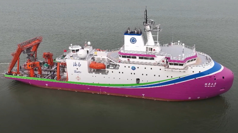
China casts its mapping project as part of its oceanic mining efforts. The industry, which is in its exploration phase, looks to mine resource-rich formations on the seafloor. Exploration contracts, which are metered out by the UN-established International Seabed Authority, are limited. To date, only 22 contractors have received exploration rights. China is by far the most represented, with state-controlled firms earning 5 of 31 ISA contracts, covering 86,900 square miles. Beijing has pioneered technological leaps in these pursuits, including a "floating island" that functions as a roaming deep sea research center.
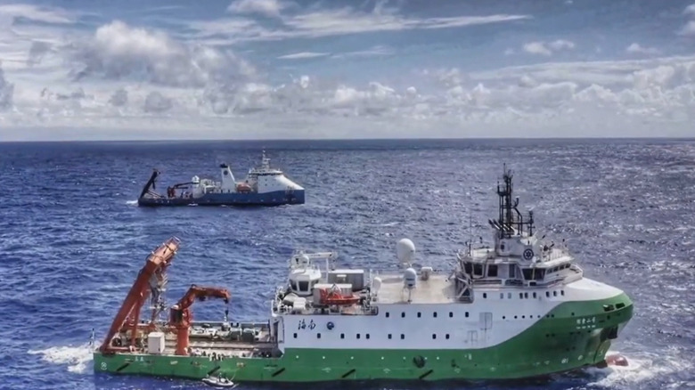
During China's seafloor mapping, ships follow a lawnmower formation, weaving tight lines back and forth to establish full coverage. Chinese vessels also deployed hundreds of underwater sensors and buoys capable of tracking water conditions and subsea movements, creating what domestic scientists dub a "transparent ocean." However, China's mapping efforts extend far beyond these designated areas. According to a joint report by CNN and Mongabay, which followed the routes of Chinese seafloor mapping ships operated by PLAN-affiliated organizations, only 6% of the ships' routes were in waters reserved for China's exploration efforts. Instead, research vessels have systematically explored areas of naval strategic importance throughout the Indian, Arctic, and Pacific oceans.
Vessels systematically mapped strategic areas surrounding U.S. allies and outposts, including those around the Philippines, Japan, Taiwan, Guam and the North Mariana Islands, Hawaii, Papua New Guinea, Australia's Christmas Island, and the American military base at Wake Atoll. Vessels also landscaped areas above Alaska, an essential route for China's Arctic stratagem. Key economic choke points, such as the Malacca Straight, were also prioritized. Critically, the full extent of China's mapping project is unknown, as vessels frequently disabled their legally mandated tracking systems, further stoking concerns.
Battling for deep sea dominance
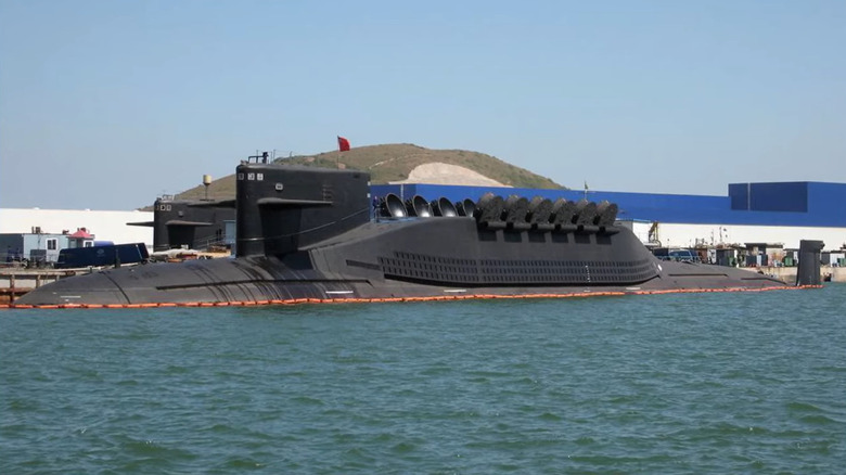
Military observers warn that China's seafloor mapping effort provides the subsurface intelligence necessary for Beijing's increasingly capable naval program, providing PLAN a better picture of potential battlefields in a naval conflict. Because submarines identify each other by their sound signatures, operators must understand how a ships' soundwaves are affected by water temperature, salinity, current movements, topography, and other environmental factors. This hydrographic data, according to U.S. Office of Naval Intelligence head Rear Admiral Mike Brookes, is critical for both avoiding detection and tracking enemy submarines (via Reuters). In a press release, one Chinese researcher overseeing the project testified to its "rapid development" of Beijing's "maritime defense and military capabilities" (via Reuters).
Geopolitical experts situate these operations within Beijing's grander military strategy, noting that the emphasis on subsurface intelligence reflects Chinese naval planners' increasingly ambitious blueprint. While mapping efforts around the First Island Chain is typical of the PLA Navy's historic emphasis on its immediate neighborhood, the inclusion of global strategic waterways is indicative of China's increasing emphasis on power projection, a trend that has seen the PLA adding fleets of advanced submarines, warships, and aircraft carriers to the world's largest navy. According to naval experts, subsurface intelligence operations is critical to maximizing these efforts.
Of course, China isn't the only nation to invest in collecting hydrographic data. The United States, for its part, has long held a strategic advantage in this domain. However, because military ships are not required to release tracking data, gauging the extent of America's subsurface intelligence apparatus is difficult. In either sense, subsurface intelligence is sure to only grow in importance, as global powers jockey for position over strategic water ways and deep-sea mining rights, a battle with potentially transformational environmental, economic, human rights, and military ramifications.